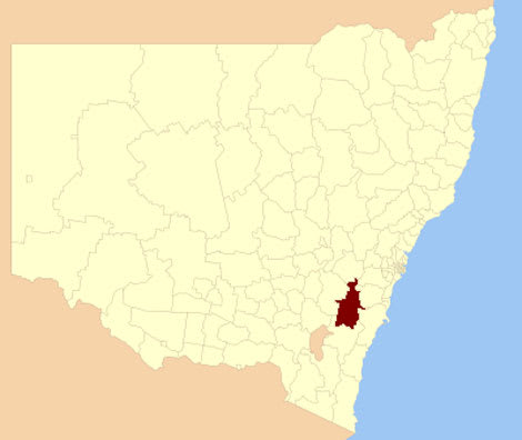
Land values fell in Goulburn Mulwaree municipality, NSW, in past three years
Land values of properties in the Goulburn Mulwaree local government area have dropped over the past three years.
The total land value of the Goulburn Mulwaree area was $2.466 billion, a decrease from the total land value of $2.517 billion determined as at July 2008.
The NSW Valuer-General has advised the value of residential land had generally shown a slight increase, the value of commercial land generally remained steady, and industrial land values have shown a decrease.
The value of rural and rural residential land has generally shown a slight decrease, while the value of village land has generally shown a strong increase.
The median rural value also eased over the past year to July 2011 from $187,000 to $185,000.
The median industrial vale eased 3% over the past year from $159,000 to $148,000.
During the past year the residential median in the municipality rose 1.2% from $91,200 to $92,300.
New values are being sent by NSW Valuer-General Philip Western to landowners of 14,236 properties.
"Real estate analysis in the Goulburn Mulwaree LGA has been comprehensive during the course of the 2011 valuation program, with 139 residential, 26 commercial, 9 industrial and 69 rural sales analysed," he said.
There were some exceptions to the norm as while the value of commercial land had generally remained steady, peripheral commercial land in the southern areas had shown a slight decrease in value.
Also industrial land values at Bradfordville and near the Goulburn Correctional Centre had generally remained steady or experienced a slight increase.
Typical residential land values were:
- 639 square metres at Chisholm Street, Goulburn valued at $83,700
- 734 square metres at Fitzroy Street, Goulburn valued at $130,000
- 613 square metres at Gibson Street, Goulburn valued at $75,100
- 792 square metres at Meyer Street, Goulburn valued at $98,600
- 564 square metres at Robinson Street, Goulburn valued at $97,900
- 753 square metres at Wilmot Street, Goulburn valued at $82,700
- 740 square metres at McGuire Drive, Goulburn valued at $92,700.
Typical commercial land values were:
- 702 square metres at Auburn Street, Goulburn valued at $185,000
- 543 square metres at Clifford Street, Goulburn valued at $141,000
- 3,766 square metres at Knox Street, Goulburn valued at $234,000
- 1,808 square metres at George Street, Marulan valued at $91,000
- 1,295 square metres at Lanigan Lane, Goulburn valued at $142,000
Typical industrial land values were:
- 809 square metres at Wayo Street, Goulburn valued at $112,000
- 5,705 square metres at Wilson Drive, Marulan valued at $275,000
- 3,000 square metres at Ross Street, Goulburn valued at $186,000
- 4.6 hectares at Finlay Road, Goulburn valued at $180,000
Typical rural land values were:
- 155 hectares at Breadalbane Road, Parkesbourne valued at $542,000
- 152 hectares at Bungendore Road, Tarago valued at $379,000
- 323 hectares at Hume Highway, Marulan valued at $1,040,000
- 144 hectares at Middle Arm Road, Middle Arm valued at $575,000
- 259 hectares at Annies Lane, Woodhouselee valued at $974,000
Typical rural residential land values were:
- 10.3 hectares at Range Road, Mummel valued at $194,000
- 10.3 hectares at Currawang Road, Tirrannaville valued at $168,000
Typical hobby farm land values were:
- 51.2 hectares at The Lookdown Road, Bungonia valued at $238,000
- 10.1 hectares at Hume Highway, Marulan valued at $140,000
- 45.7 hectares at Braidwood Road, Tarago valued at $289,000
- 40.6 hectares at Steins Road, Middle Arm valued at $231,000
- 23.8 hectares at Hume Highway, Marulan valued at $173,000
- 37 hectares at Hume Highway, Yarra valued at $185,000
- 40.1 hectares at Trappers Way, Mount Wayo valued at $210,000
Typical village land values were:
- 2,049 square metres at Stewart Street, Tarago valued at $83,900
- 1,993 square metres at Gold Field Road, Tallong valued at $61,900